Welcome!
20 August 2011 at 20:09 | Posted in Uncategorized | Leave a commentWelcome to my blog, London’s Docklands, past and present.
In this blog I’ll be posting up occasional updates based on this theme; I have a collection of interesting London Docklands material which may otherwise be tricky to find, but I’ll also be adding posts about Docklands today. To find out more about me, see the About me page.
I hope you’ll find it interesting; if you want to subscribe to get updates, please see the link on the right.
New University campus in Canada Water?
9 March 2013 at 11:31 | Posted in Docklands present, Maps and plans, Photos | 5 CommentsTags: campus, Canada Water, KCL, Kings, Kings College London, Rotherhithe, SE16, Southwark, University
At the moment, the University of East London (UEL) is the only Docklands-based university, although Ravensbourne College also recently moved from Bromley to the Greenwich Peninsula.
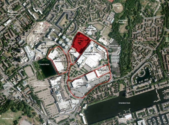
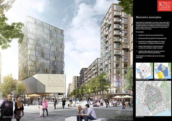
Now, however the prestigious Kings College London is eyeing a new campus opportunity near Canada Water. They have taken an option on the former Mulberry Business Park, and last week displayed their plans for 750 student rooms along with a new office and postgraduate accommodation, affordable housing, and some ancillary uses such as cafes and possibly some small retail units.
At the exhibition I attended, there was a good deal of support from local people, myself among them. It should bring hundreds of people through the area during the day, and with no car parking, the impact on traffic will be minimal.
What’s even more interesting is that while this is a standalone proposal which they are seeking to progress in time for the September 2016 student intake, KCL are also looking at what opportunities the relocation of Harmsworth printworks may bring. KCL don’t own the print site, but are drawing up a masterplan which includes using part of that site to not only extend the student and staff accommodation, but to also potentially bring teaching and leisure uses to the site, creating a Canada Water campus. These are very exciting plans, and I think would bring some very welcome activity to an area which can be very quiet by day when everyone’s gone off to work.
There is a lot of detail currently available on KCL’s website here, but a few photos from the exhibition below give an impression of their ambition. They are hoping to submit a planning application to Southwark for the Mulberry site in Spring 2013.

Model of proposed student block

Model of masterplan for Canada Water
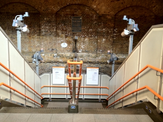
Wapping station, then and now
13 October 2012 at 11:56 | Posted in Docklands past, Docklands present, Photos | 2 CommentsTags: E1, Overground, station, Tower Hamlets, Tube, Underground, Wapping
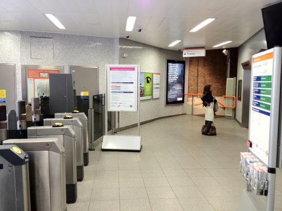
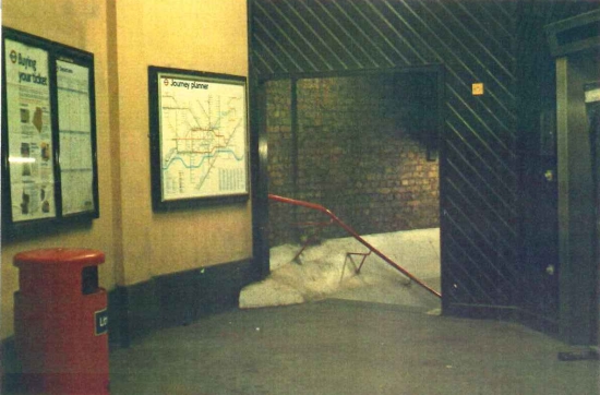
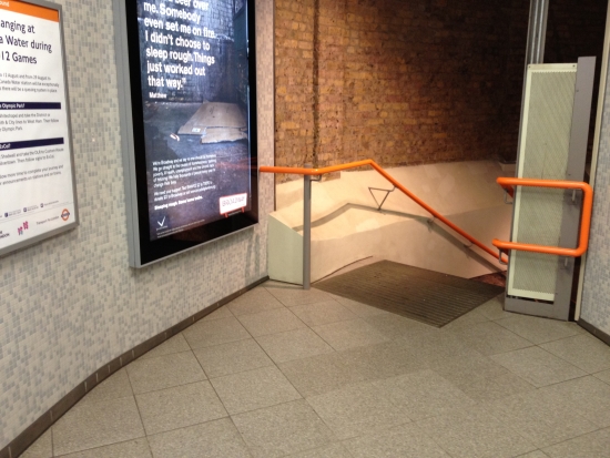
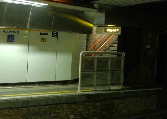
Wapping station opened with its southern sister Rotherhithe in 1869, when the Thames Tunnel was converted from a foot tunnel to a railway. When London Underground closed service on the East London line in December 2007 for its transfer to London Overground, the station – along with others along the route – got a substantial facelift, as the following photos illustrate. The older pictures were taken around 1990, and the newer ones during the summer of 2012.
The station entrance has been rotated; where previously there was a narrow at the western corner, today there is a brighter entrance from the centre of the booking hall:
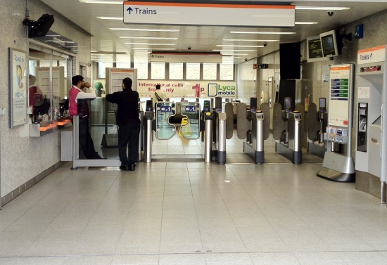
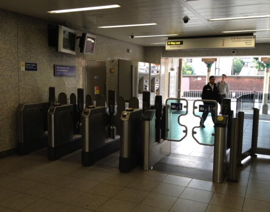
The ticket hall is virtually unrecognisable, with the entrance and staff accommodation moving, and the gateline being reorientated 90 degrees to face the larger entrance:
The top of the staircase from the ticket hall:
The bottom of the lifts:
The southbound platform from the northbound platform:
Much smarter stair access:
Top of the northbound platform:
Looking along the southbound platform:
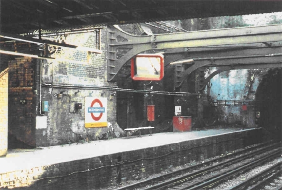
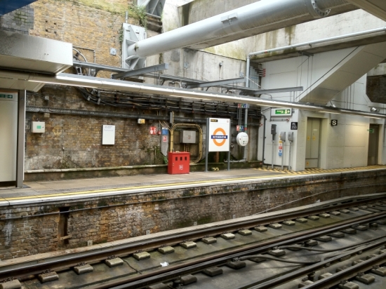
Rotherhithe station, then & now
2 September 2012 at 17:41 | Posted in Docklands past, Docklands present, Photos | 1 CommentTags: Overground, Rotherhithe, SE16, Southwark, station, Tube, Underground
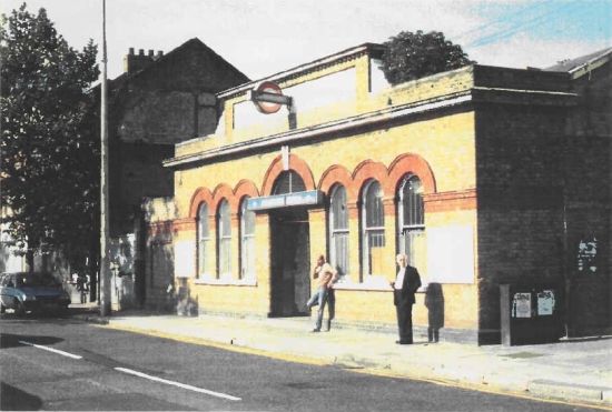
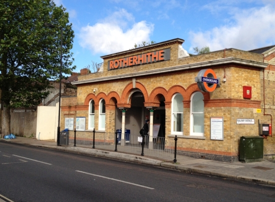
 Rotherhithe station first opened in 1869, when the Thames Tunnel was converted from a foot tunnel to a railway. It has changed a lot over the years, particularly above platform level, and when London Underground closed service on the East London line in December 2007 for its transfer to London Overground, the station – along with others along the route – got a substantial facelift.
The change over just the last 20 years is quite striking, as the following photos illustrate. The older pictures were taken around 1990, and the newer ones during the summer of 2012.
The station facade has been opened up to enlarge the entrance, making it more accessible and welcoming as these shots from 1990, 2007 and 2012 illustrate:
The ticket hall is virtually unrecognisable:
And as it looks to departing passengers: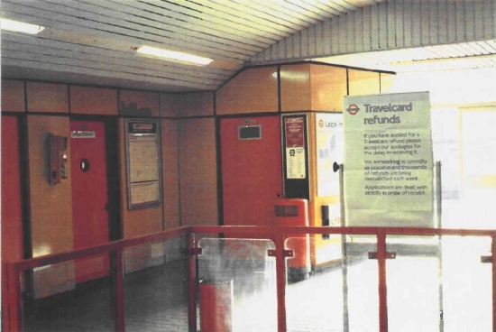
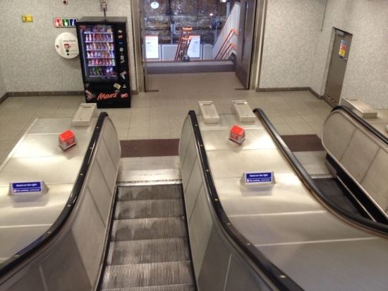
The orange & brown later 1970s look has been replaced with a much more modern escalator enclosure:
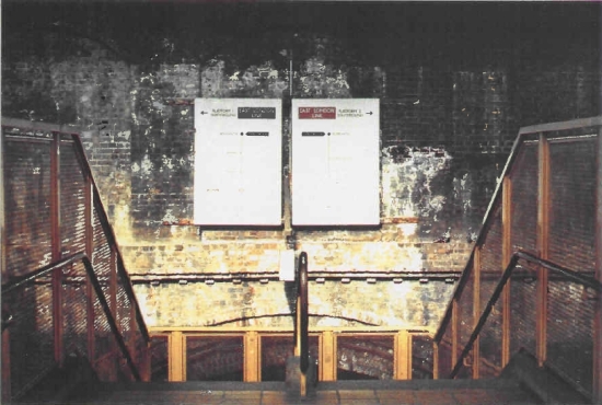
The final drop to the platform is by stairs due to a lack of space for the escalators, and these too have been spruced up:
The bottom of the stairs are shown in these shots:
The platforms were pretty dreary before the 1990s installation of bright enamel panels along the walls. In the 1990 picture the view down the northbound platform shows the fairly dingy atmosphere compared with the modern shot:
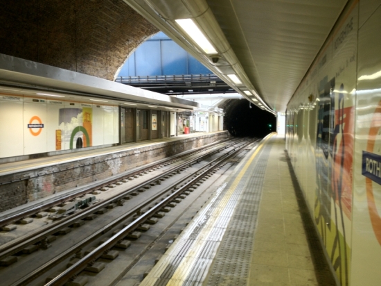 Looking north along the same platform:
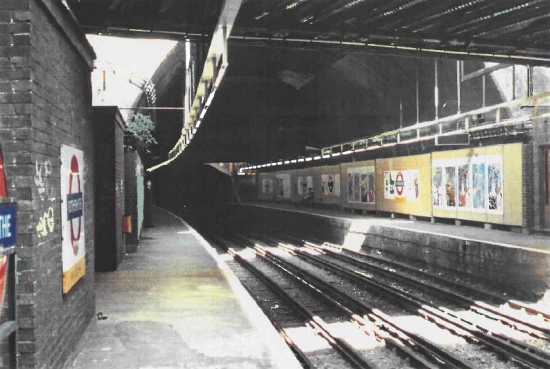 The southern end of the platforms lie under the Rotherhithe tunnel, which passes above. This view shows the southern end of the southbound platform with the Rotherhithe tunnel structure just visible, and in the modern shot shows the new emergency escape stairs to Albion Street, installed to supplement the main stairs in the event that a train needs to be evacuated:
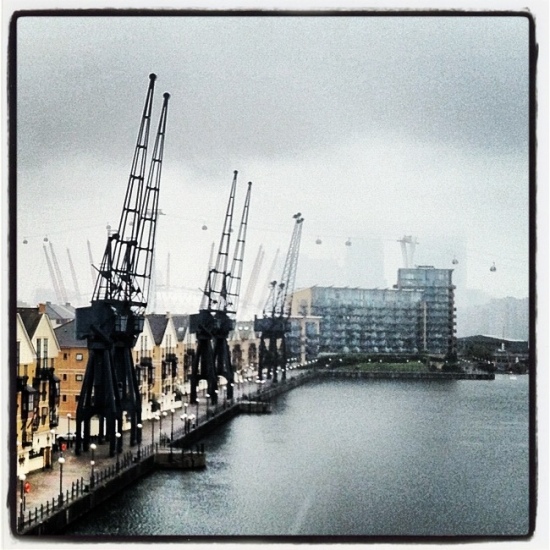
Rainy day in the docks
14 July 2012 at 22:46 | Posted in Docklands present, Photos | Leave a commentTags: Royal Docks
Very rainy day to go wandering with friends around the docks with friends, but it still manages to retain an interesting and moody air.
Building the Jubilee line at Canada Water
12 July 2012 at 20:36 | Posted in Docklands past, Docklands present, Photos | Leave a commentTags: Canada Water, Jubilee, Olympics, Rotherhithe, SE16, Southwark
In a couple of weeks, the Jubilee line will be one of the most crucial transport links serving London’s Olympic Games, serving not only the Olympic Park at Stratford but also the North Greenwich Arena (as the O2 is temporarily called), ExCel via Canning Town, and football at Wembley, as well as serving the many events in central London from beach volleyball, the marathon and triathlon to the parallel festivals.
So it’s easy to forget just how new the eastern part of the line is, opening only in 1999. The rebirth of Docklands pre-dates the eastern extension of the Jubilee line, but undoubtedly without it a great deal of the new development you can see today would not be there without the new tube line.
Canada Water is a good example of an area which is still undergoing its transformation, with a new centre beginning to arise around the tube station where until recently there was only tumbleweed.
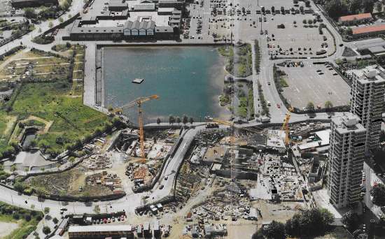
The picture below (click to enlarge) was taken in 1996 looking south, and shows the large station box running from left to right, with a temporary bridge over it carrying Surrey Quays Road.
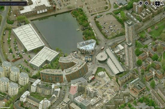
The picture below from Bing maps shows the area in about 2011; the buildings are slightly distorted on account of this being a stitch of more than one image, but the transformation over the past decade and a half is very evident. The circular building in the centre-right of the picture is the tube station, with the bus station to the right and adjacent to it. Above and to the left is the new Canada Water library, under construction in this photo but which actually opened late in 2011.
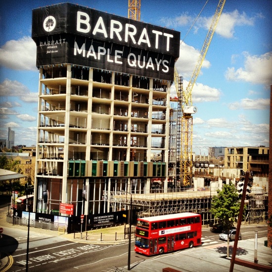
The vacant plot immediately below the station in the photo is Site A of the Barratts development, home to a fast-rising 80 metre tower with 26 floors.
All change at Canada Water
13 May 2012 at 10:45 | Posted in Docklands present, Photos | 1 CommentTags: Canada Water, SE16, Southwark
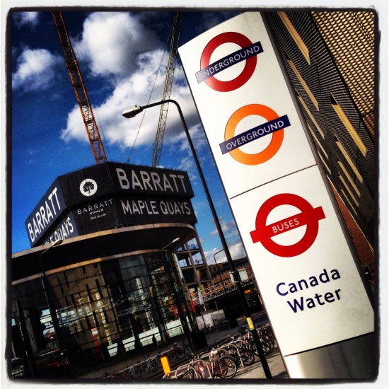
The pace of change at Canada Water is growing, with the area adjacent to the station now really beginning to feel like a proper urban place. Here’s a quick update of the new Ontario Point tower under construction and on its way to 26 floors, opposite the new library:
Building the Blackwall Tunnel Approach Road
23 April 2012 at 20:00 | Posted in Docklands past, Docklands present, Maps and plans | 1 CommentTags: Blackheath, Blackwall, Charlton, Greenwich, Kidbrooke, SE10, SE3, SE7
The Blackwall Tunnel may be the bane of many east and south east London residents’ journeys, but imagine trying to get around the area by car without it. It’s actually been there for much longer than you may imagine, the first (now northbound) tunnel opening way back in 1897, with the second (now southbound) tunnel following in 1967. But for many years, it was a pretty local crossing, accessed by narrow approach roads and without much of a strategic function.
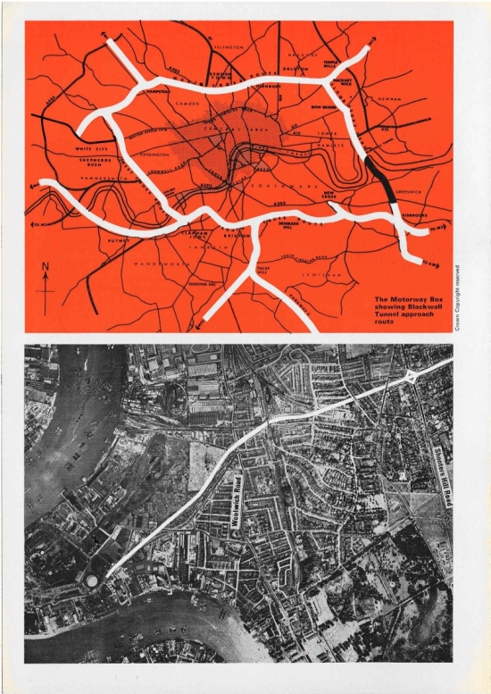
But when the second tunnel opened, it was part of a much larger plan for a series of urban motorways, or ringways, around London; this link was to form the eastern part of Ringway 1, or the Motorway Box.
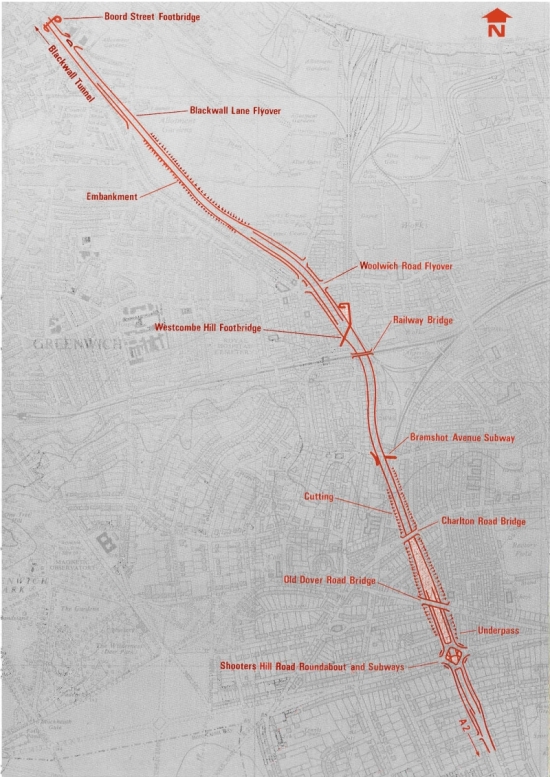
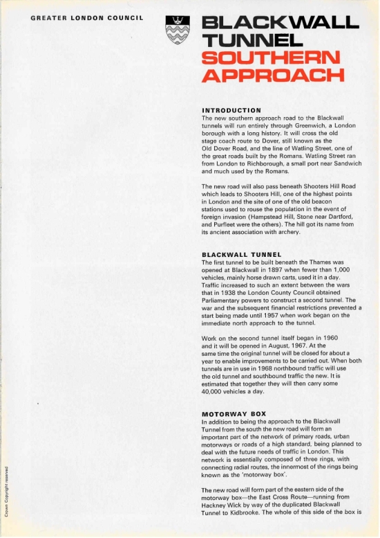
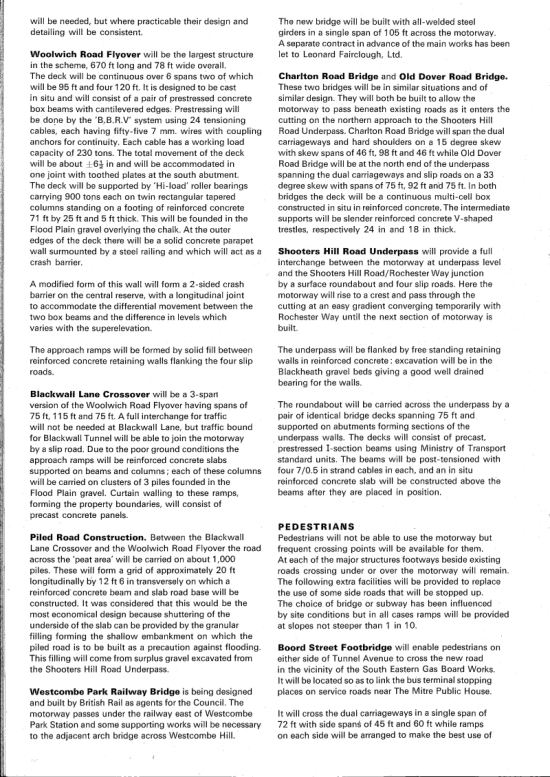
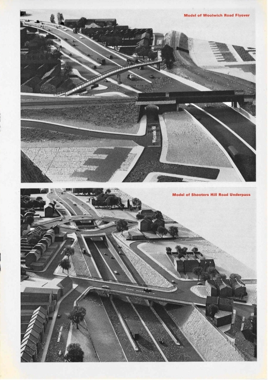
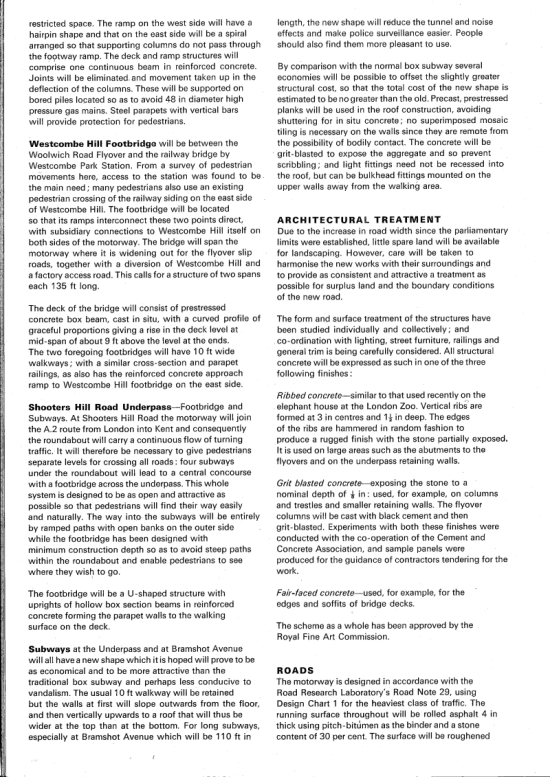
The section approaching the Blackwall Tunnel in the south needed to be upgraded to allow the tunnel to play a larger role in the road network, and in 1968 the GLC (Greater London Council) published a leaflet setting out how this would be achieved; essentially, by ploughing an urban motorway through the Greenwich, Charlton and Blackheath borders.
The road was duly built as planned, although you’ll have noticed that the motorway box was never completed; the public tide turned against major road building in the capital in the 1970s, and the motorway box was dropped, leaving a few short sections – including the Blackwall tunnel approaches – as marooned motorways. These sections – then the A102(M) – didn’t even join up with the roads out to the edge of London, with the section through Eltham completed in the mid-80s, and the section through Leyton even later.
 The roads ceased to be classed as motorways in 1999/2000, although this message hasn’t entirely got through to the designer of this newish sign I recently spotted on the A2, just before the M25 (picture from Google Streetview), which sports the road’s old A102(M) number.
The leaflet makes an interesting read, going into a surprising amount of detail, and offers a glimpse into the recent past.
Greenwich Peninsula and the mystery stadium
27 February 2012 at 19:24 | Posted in Docklands present, Football | Leave a commentTags: cable car, CAFC, Charlton Athletic, cruise ship terminal, Emirates Air Line, Greenwich Peninsula, SE10
Parts of the Greenwich Peninsula have been redeveloped in recent years, with the O2 the most high-profile new development on the peninsula and some others to follow, including the Emirates Air Line cable car to the Royal Docks. Gradually the areas to the east of the peninsula are being developed, with a commercial heart around the tube station slowly emerging, and with fairly advanced plans for more development around the top of the peninsula, including AEG’s planned hotel.
The western side of the peninsula, however, has remained strictly industrial until recently, but the sands are beginning to shift.
The first residents are living in the Lovells Wharf development closest to Greenwich, and the Enderby’s Wharf proposals – complete with a cruise ship terminal capable of handling ships up to 240 m long – gained planning permission a while ago and could come forward soon.
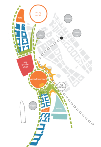
With all this activity in the area, the London Royal Borough of Greenwich has produced a new masterplan for the western part of the peninsula, to set out some planning parameters for the new developments which will over time edge out the current industries, if the borough has its way. The council is seeking comments on the draft until the 9th March.
New 40,000 seat arena/stadium
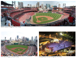
For me the stand-out feature of the masterplan is that it’s been planned around a new 40,000 seat arena, seemingly based on American baseball grounds in concept (or at least, that’s how it’s being presented). This would be an open bowl, with the main stands to the south and east and open views towards Canary Wharf. This would seemingly be principally for open-air concerts, and there is some logic to this; AEG – operators of the nearby indoor O2 Arena – clearly think there is a market for outdoor concerts, as this was a part of their failed bid for the Olympic Park, and they are installing a temporary venue on the peninsula for summer 2012. In addition, there has very recently been a row over concerts in Hyde Park, so a purpose-built venue for such gigs could clearly have a place in London’s summer calendar. However, you have to wonder whether one of London’s many existing stadia could perform this function, and indeed whether the plans for lots of residential property next door rather undermines the ability to play loud live music. And it seems to me that this can’t possibly be sufficient reason to build such an expensive arena.
So what of other uses? The documents refers rather obliquely to the arena being “integrated with an elite sports facility” – or, in plain English, maybe it would be used by a professional sports team. Whatever could they mean? The examples in the document are baseball arenas, but with the best will in the world I can’t see professional baseball taking off here any time soon, even though I enjoy baseball personally. The oval shape would be well suited to cricket, and perhaps Kent could be persuaded to play some Twenty-20 cricket here – south east London is underserved by the traditional county, and Kent have shown an interest in playing in London, with a home game at the Oval in 2010 and even showing some interest in the Olympic stadium. Unlike those venues, this is within the traditional county of Kent (who have in the past played locally at Blackheath) so perhaps this would work. But one or two Twenty-20 games a year isn’t going to pay the rent any more than some outside gigs, and they’d be competing for the best summer weather.
With respect to the historic Blackheath rugby club nearby, rugby’s not a very south east London sport and doesn’t pull in the sort of crowds which would be at home in a venue of this size. Which pretty much leaves football.
As luck would have it, there is a professional club not far away in the form of Charlton Athletic. Due to their travails in the 1980s which saw the club forced out of the Valley and having to groundshare at Selhurst Park and then briefly Upton Park, the fans of Charlton are probably even more attached to their home than most fans, but in this day and age it’s becoming more accepted that at times a move can be justified.
So would Charlton be in the market for a new ground? It isn’t immediately obvious why they should be; the Valley is a pretty good ground, three of the four sides have been rebuilt since their return 20 years ago, and the 27,000 capacity is rarely met at present.
However, that 27,000 capacity is not perhaps as generous as it sounds; the club are currently in League One, and this is likely to be a temporary situation. Just the other day, a Football for a Fiver promotion brought a sell-out crowd of 26,500 (allowing for segregation) against Stevenage. The club have advanced plans to extend the Valley to 40,000 to cater for larger crowds, but this is expensive and doesn’t come without difficulties. For starters, the transport capacity getting away from the Valley on a matchday is limited, with crowd control at the station and very busy roads.
A new home on the Greenwich Peninsula would take the club out of Charlton, but only marginally, and would still be in the borough of Greenwich. The ground would still be within walking distance of the same railway line through Woolwich, albeit with a longer walk, and without the odd Blackheath line train. But there would also be the option to walk to North Greenwich for the tube (admittedly of less use for local fans but perhaps handy for some, and certainly away fans) and for lots of buses through SE London, and to walk into Greenwich for the DLR to head south. There is lots of parking for the O2, which could probably be used on a matchday provided no major events coincided, and there is a coach station nearby.
I have no idea how the finances would stack up, as I cannot imagine that the sale of the Valley would come anywhere near the cost of a new stadium, even when the extra capacity is added in; but perhaps the stadium is the catalyst which would unlock the surrounding land for the more profitable business of home building, and the extra concerts and no doubt hospitality would all contribute additional sources of revenue which could help to get it off the ground. I’ll be watching this one eagerly.
DLR extension
The plans also show Greenwich’s plans for a DLR extension towards Eltham. I have some sympathy for the concept of extending a line to the south east – south east London is under-served by public transport compared with other areas, and most of the railways by-pass Docklands and head straight for central London, putting a lot of pressure on those links which do run south (like the Lewisham DLR branch). But I’m not entirely convinced by this scheme as drawn by Greenwich; it would be hugely expensive (about £1 billion), and yet still wouldn’t provide a direct link to Canary Wharf, as once it gets to the Greenwich Peninsula, it heads for Canning Town (or even West Silvertown, if the terrible rail plan in this document is to be believed). This would simply pile more people onto the very busy Jubilee line for one stop.
If you’re going to go to the trouble and expense of building a light railway up to the Greenwich Peninsula from the south east, at least turn left instead of right when you get there, and drop people off at Canary Wharf – put a station below the southernmost West India Dock, just as the Jubilee line and Crossrail stations are built on the site of the other docks. And while you’re at it, keep going to serve the Rotherhithe peninsula and Canada Water to relieve the Jubilee line some more and link to the Overground for a really useful link.
Stunning views from the Shard
18 January 2012 at 21:40 | Posted in Docklands present | 2 CommentsJust a very short update tonight to highlight an amazing photo, taken by Will Pearson from the top of the Shard. It is a dusk photo, taken in November 2010, showing the full 360° panorama from 310 metres above central London.
The view down the river through Docklands is stunning, and can be viewed in full screen, and you can pan around the image and zoom in.
Take a look for yourself here, and enjoy.
Stave Hill
29 December 2011 at 22:03 | Posted in Docklands past, Docklands present, Photos | 3 CommentsTags: LDDC, Rotherhithe, SE16, Southwark
 Stave Hill is a wonderful hidden secret of Rotherhithe, a 10 m high artificial mound alongside Russia Dock Woodland, lifting visitors just high enough to see over the rooftops.
The area is naturally very flat; until the Surrey Docks were built, the whole area was marshland, with occasional flooding on the highest tides. When urbanisation reached the area, and the Thames wall sufficiently protected from the tides, the site of Stave Hill became a part of Russia Dock, named for one of the countries which did business with the Surrey Docks.
Following the closure of the docks, Russia Dock was filled in, along with most of the Surrey Docks, while the GLC and local borough debated what should become of the area. In the 1980s the London Docklands Development Corporation controversially took over the task of regeneration, and set about creating some new open spaces around which residential development could take place.
The LDDC realised that while plenty of land would be needed if they were to create the number of homes they envisaged, they at least had the foresight to realise that infilling the waterways almost in their entirety left the centre of the peninsula with little character to build on, so a new canal – the Albion Channel – was dug, from Surrey Dock (now Surrey Water), through the former site of Albion Dock to the remaining part of Canada Dock, now Canada Water (the rest of the dock lying underneath Surrey Quays shopping centre and part of its car park).
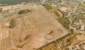
What to do with the spoil? Another part of the LDDC’s plan was a landscaped park centred on Russia Dock, but being very flat now (having been entirely filled in) there was nowhere that a visitor could go to take a view. The spoil from Albion Channel thus gained a home as an artificial hill alongside Russia Dock Woodland, providing some much appreciated elevation within the otherwise rather flat area. (The approximate location of Stave Hill is circled in the aerial photo above).
Stave Hill is approached from Dock Avenue, a residential pedestrian street linking Stave Hill (and Russia Dock Woodland) with Timber Pond Road, now much shadier than it was in 1987!
The first image below is from circa 1987, and shows the view across the rooftops of houses just being completed, to the City in the distance, with a single prominent tower (then still called the NatWest Tower, now Tower 42). (Click on any images for a larger version.)
By 2008, the view looks quite different, with the trees maturing, and some notable new buildings appearing in view, including the City’s Gherkin.
Finally, in late 2011, another new building in the City has joined the cluster, Heron Tower, slightly to the right (north) of the Gherkin and Tower 42.
Just out of shot in the above frames is the Shard, the new 310 m high tower on the south bank of the Thames at London Bridge; it can be seen in the wider view below:
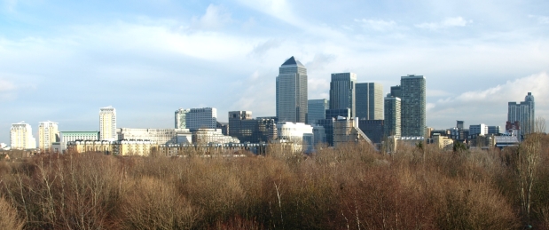
Oh, and the view towards Canary Wharf’s not bad, either…
Blog at WordPress.com.
Entries and comments feeds.
